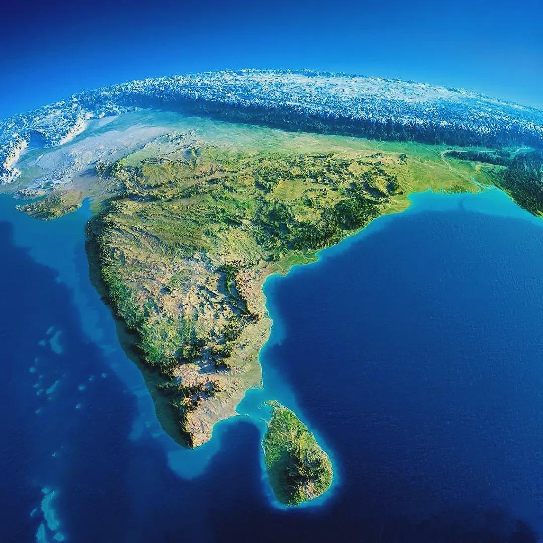
Topography of India depicting Himalayas like The Wall in the North from the Game of Thrones. India rests upon a tectonic plate which is still pushing northward into Asia(or Eurasia) which means Himalayas are still growing up at around 0.5 to 1 cm per year.
by binga001

18 Comments

It’s one of the few places on Earth where you can point at a map and say “this shit is still being built.”
And people ask why China’s never tried to invade India or the other way around.
Source: https://www.geolsoc.org.uk/Plate-Tectonics/Chap3-Plate-Margins/Convergent/Continental-Collision.html
Edit: With source, I meant source for the rate of increase of Himalayas’s height and not image.
Ironically, I saw the Himalayas over the holidays and I asked, “is it me or did you get taller?”
Well it is called the subcontinent for a reason.
Are you saying that the Himalayas still has a chance of growing taller but not me?
All of you who’ve climbed Everest need to do it again since it is higher now.
Big if true
It grows due the amount of plastic ….
Damn, north Sri Lanka must have some killer views across the sea
Very exaggerated image, basically useless.
There is less than a 0.15% variance between sea level and the highest mountains or lowest trenches in the ocean.
This is most likely a shitty AI generated image
My first thought “So….how fast does the crustal root deepen to compensate?”
Is this why it’s considered a “subcontinent?” Because it’s on its own continental plate?
Fun fact if you could grow huge like some cosmic giant to be able to hold planet Earth in the palm of your hand it would feel smooth like a billiard ball.
Ironically, theres a dragon on the other side that can knock it down.
Sri Lanka looking pretty
Fake image. Sri Lankas position is incorrect. Andaman and Nicobar islands don’t even show. Bangladesh is also some weird water/green mix